Category - GCP,Ground Control Points
Posted - 05/30/2017 11:01am Ground Control Points (GCPs)
What Are Ground Control Points?

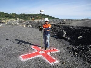
Ground Control Points, or GCPs, are marked points on the ground that have a known geographic location. In aerial surveying, a drone can be used to autonomously collect photos of the survey area. If used, GCPs must be visible in these aerial photos. The photos are then processed in the cloud using drone mapping software. A common solution for collecting and processing drone data, used by many mapping professionals, is DroneDeploy. Services like DroneDeploy create 2D orthomosaics, 3D models, digital elevation models (DEMs), and 3D point clouds from drone images. For aerial survey applications GCPs, are typically required as they can enhance the positioning and accuracy of the mapping outputs. To do this correctly, the GCPs and desired mapping outputs must use the same ESPG code.
When Do You Need GCPs?
YOU DON'T NEED GCPS
You do not need GCPs if only relative accuracy is important. Drone mapping projects that only require high relative accuracy include:
- Measuring length, area, and volume of objects

- Construction Site Management and Oversight

- Crop Scouting

- Creating Marketing Material

YOU DO NEED GCPS
If absolute accuracy is important then you will need use GCPs on your map. Drone mapping projects that require high absolute accuracy include:
- 
Land Title Surveys

- As-Built Surveys

- Environmental Documentation

- Overlaying Geo-Referenced Site Plans
Read More
https://www.groundcontrolpoints.com
- All
- Agriculture
- Altitude
- California
- Commercial
- Construction
- Crop Science
- Drone Guns
- FAA
- GCP
- General
- Ground Control Points
- Industrial
- Instruction
- Insurance
- Legal
- Light
- Mapping
- NDVI
- Photogrammetry
- Photography
- Public Concern
- Regulations
- Reviews
- Safety
- Security
- State PArks
- Stitching
- Terrain Mapping
- Vineyards
- Volume Measurement
- Webinars
- Wildfires
- Wine Country
- May 2017

